Hurricane Nolo Hawaii: Travel Advisory September 2026
On Thursday morning, Troy Gacayan was still patching the roof his family lost to Hurricane Lala in August. By Friday, he was bracing for another hit. “We’re slowly starting to rebuild, but now it’s almost like if this storm hits, it’ll smash us back down,” the high school teacher and pastor from Hawaii’s Big Island told Honolulu Civil Beat.
Gacayan’s situation captures what made Hurricane Nolo so brutal: it didn’t arrive simply as a storm. It arrived as a gut punch to communities that were already on their knees.
Nolo swept south of the Hawaiian islands between September 25 and 27, 2026, carrying enough wind and rain to trigger life-threatening flood warnings across four counties. The National Hurricane Center was blunt - “catastrophic life-threatening flooding and mudslides, especially in areas of steep terrain.” The storm has now passed, but the questions it raises for travelers are very much live. If you have a Hawaii trip coming up in the next few weeks, here’s what you need to know.
What Hurricane Nolo Actually Did to Hawaii
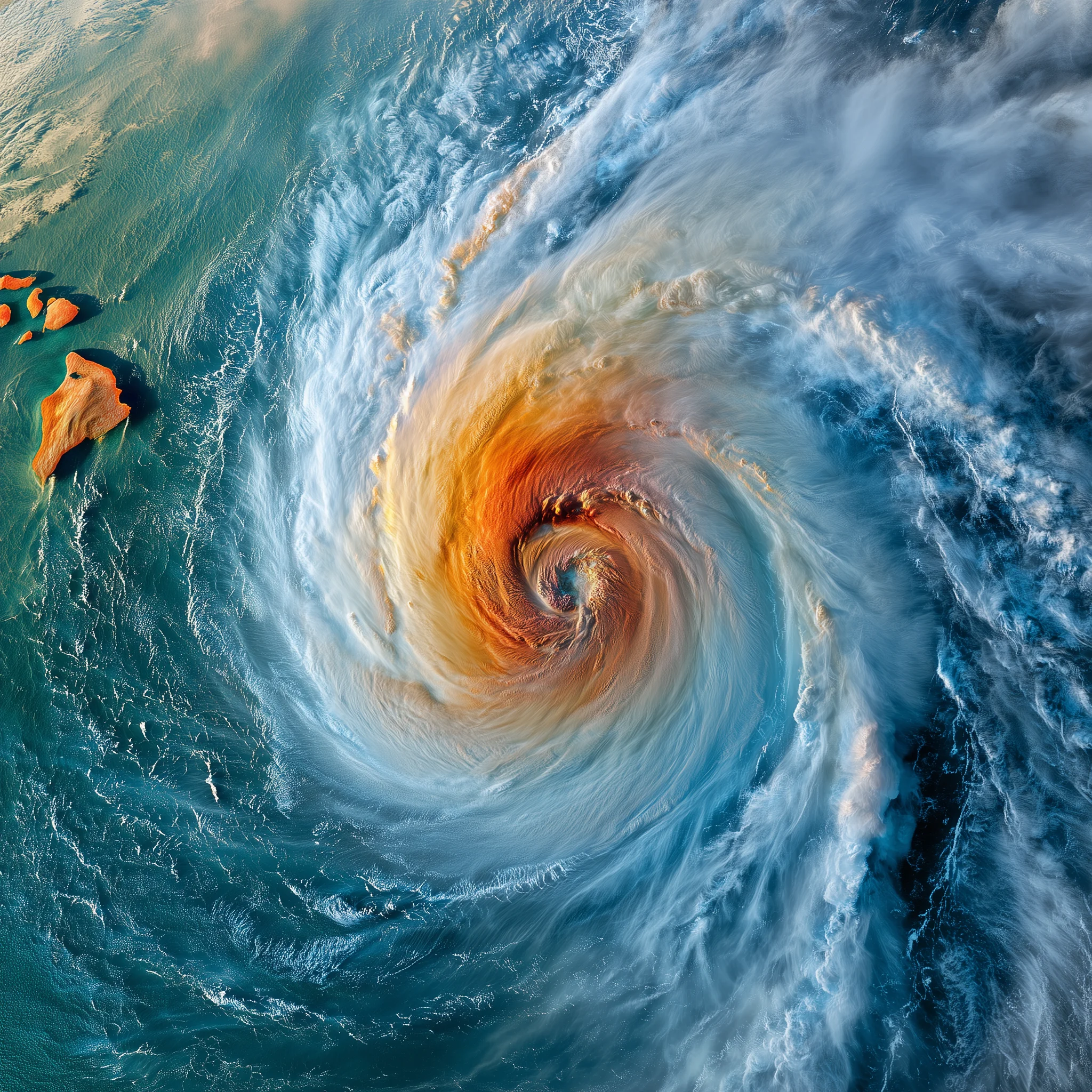
Nolo reached Category 2 strength as it moved west of the island chain, packing maximum sustained winds of around 105 mph. As of Friday morning (September 25), the center sat roughly 200 miles south of the Big Island and was tracking north-northeast - close enough to bring tropical storm conditions by Friday evening and heavy rainfall through the weekend.
The core threat was water, not wind. Forecasters warned of up to 25 inches of rainfall in the most exposed areas, particularly on windward slopes and valleys with steep terrain. That kind of rainfall total in a compressed window isn’t a flash flood risk - it’s a landslide and road-obliteration risk.
Hawaii activated more than 230 National Guard members ahead of the storm. Schools across the affected counties closed Friday. Governor Josh Green requested an emergency disaster declaration for four counties to unlock federal funds and emergency support - the request was pending federal approval as of late Sunday.
Canada’s Department of Global Affairs updated its travel advisory for the United States specifically on September 25, warning that Nolo was expected to bring “excessive rainfall, storm surges and violent winds” to the Big Island and Maui, with potential for flash flooding and landslides “especially in higher terrain.”
By Saturday morning, Nolo had moved west of the islands. Wind warnings remained active for portions of Maui, the Big Island, Molokai, and Lanai - specifically in areas with significant terrain exposure - but the worst of the rain was done. By Sunday, blue skies had returned to Oahu.
Which Islands Were Hit Hardest
The heaviest impacts fell on the Big Island (Hawaii County) and Maui. Both carry the combination of high terrain and deep valleys that channels rainfall into fast-moving floods.
The Big Island’s Hilo side - already accustomed to heavy rain - faced the brunt of Nolo’s eastern rain bands. The Kohala region and the slopes above Kona sat in the path of the strongest gusts. Wind warnings covered portions of “west Maui and Kohala” specifically, according to the NHC - areas where “damaging winds may blow down trees and power lines and damage roofs.”
Maui’s famously scenic Hana Highway became an immediate problem. The Hawaii Department of Transportation strongly discouraged travel to Hana, citing the combination of heavy rain, rockfalls, and road surfaces that can shift from difficult to impassable within minutes on that stretch. It’s a road that requires full attention on a clear day. After 25 inches of potential rain, it’s a road to avoid until conditions are formally assessed.
Molokai and Lanai also fell under wind and rain advisories, though both smaller islands tend to see less catastrophic flooding than the Big Island or east Maui.
The context that made all of this significantly worse: large portions of the Big Island are still recovering from Hurricane Lala, which hit in August 2026. We covered Lala’s impact and the travel picture from that storm in detail here. Some residents from that event remained displaced. Roads that washed out in August hadn’t fully reopened. Emergency infrastructure was already stretched when Nolo arrived.
“There is a reason these destructive disasters are piling up one after another, leaving communities exhausted and governments depleted,” Senator Brian Schatz told Congress this week. “It is the warming planet.”
Flight and Ground Disruptions Travelers Faced
Unlike events where airports take the direct hit, Nolo’s primary disruption to visitors was on the ground.
Hilo International Airport (ITO) and Ellison Onizuka Kona International Airport (KOA) remained operational through the storm’s passage, though incoming flights saw weather-related delays tied to heavy rain bands Friday night into Saturday. Kahului Airport (OGG) on Maui continued operating, but travelers landing there who planned to drive the Hana Highway found that the DoT advice was to simply not attempt it.
For visitors already on-island, the uncertainty was about ground movement. Certain routes on the Big Island - particularly around Puna and South Hilo - are built on volcanic-age road surfaces that deteriorate quickly under prolonged heavy rain. Landslides on steep mountain roads can close routes with little warning and no viable alternative.
Some visitors described watching the storm’s progress and wondering whether departure options would hold. Daniel Compton, visiting from Seattle, put it plainly to reporters: “I guess that’d be my concern - whether we’re getting out of here or not.”
Rental car companies in some areas restricted use of their vehicles on certain back roads and trailheads during active weather conditions. Any hiker with plans at Hawaii Volcanoes National Park or the Mauna Kea summit access road found those activities suspended for the duration.
What Travelers with Upcoming Hawaii Trips Should Do
If you’re heading to Hawaii in the next two to four weeks, Nolo’s aftermath is the key travel variable to check before you go.
Check road conditions before you fly. The Hawaii Department of Transportation maintains updated advisories at its official site. After any major storm, Big Island routes through Puna, back roads around Hilo, and the Hana Highway on Maui can be closed or navigable only with high-clearance vehicles. Conditions listed last month are not conditions listed today.
Call your accommodation directly. Smaller properties on the Hana coast or in remote Big Island areas may be dealing with power outages, water pressure problems, or access issues even if their booking systems show availability. A five-minute call before you fly saves significant grief on arrival.
Check for airline waivers. Major carriers regularly issue fee-free rebooking waivers when a storm directly affects Hawaii. If you were booked to fly into Hilo or Maui between September 25 and 27, check with your airline about whether a waiver applies to your ticket even if you weren’t forced to cancel. Hawaiian Airlines, United, and Alaska Airlines all have histories of issuing waivers for significant Hawaii weather events.
Look at your travel insurance policy carefully. If your trip overlaps the storm period or immediate aftermath, several coverage types become relevant:
- Trip interruption - if you’re already in Hawaii and your accommodation is inaccessible, or if mandatory evacuation orders were issued for your area
- Trip cancellation - if you hadn’t yet departed and a government travel advisory was in effect for your specific destination
- Travel delay - if flight disruptions kept you on-island or grounded at a connecting city longer than expected
Not all policies treat storms the same way. Read the specific language around named storm exclusions and government advisory requirements before assuming you’re covered.
The Bigger Pattern: Hawaii’s 2026 Hurricane Season
Nolo is the third named storm to significantly affect Hawaii this season. The conversation has shifted from “unusual” to “what does this mean for future planning.”
Hawaii has historically been considered relatively low-risk for direct hurricane impacts. Storms in the Central Pacific often weaken or track away before reaching the islands. That statistical comfort is being updated in real time. Senator Schatz’s comments to Congress this week reflected a wider acknowledgment among Hawaiian officials that back-to-back seasons like this one are reshaping what travelers and residents should plan for.
For travelers, that means treating the June-to-November window with more respect than a footnote in the booking process. It means building flexibility into itineraries that depend on specific roads or outdoor activities. And it means having travel insurance that actually covers weather disruptions - purchased before any storm is named, which is the threshold most policies use to define coverage eligibility.
Practical Checklist for Hawaii Travel This Fall
If you’re booked to visit Hawaii between now and December, here’s what to do before you go:
- Buy travel insurance before a storm is named. This is the single most important planning step. Once a storm like Nolo is named, policies bought after that point typically exclude coverage for it. If you’re not yet insured for your upcoming trip, buy now.
- Register with your government’s traveler alert system. US travelers can enroll in the STEP program at travel.state.gov for direct government notifications. Canadians can register at travel.gc.ca. It takes about three minutes and gets you direct alerts for significant events at your destination.
- Download the Sitata app to receive real-time safety alerts tied to your specific itinerary, including storm warnings, road closures, and health advisories for your destination dates.
- Know where the emergency shelters are before you arrive. The Hawaii Emergency Management Agency publishes shelter locations for each county. Save them to your phone before departure - if you need them, you’ll need them fast.
- Drive the Hana Highway only after checking current conditions. Even in good conditions, this road demands full attention. After Nolo, the DoT will need time to assess and repair rock-fall areas, guardrail damage, and road surfaces. Confirm conditions directly before making the drive.
- Have a flexible day built into your Big Island itinerary. The combination of Lala and Nolo damage means some roads and parks may reopen on an unpredictable timeline. If your entire itinerary depends on a single route opening, build in an alternative plan.
What the Recovery Looks Like from Here
As of September 28, Hawaii officials were beginning damage assessments across the counties covered by Governor Green’s emergency declaration request. The federal response - pending White House approval - will shape how quickly major infrastructure repairs can move forward.
For most travelers arriving from early October onward, Hawaii’s core infrastructure will be operational. Major airports are running. Oahu, Kauai, and most of Maui’s resort corridor are functioning normally. The areas that warrant the most caution are the Hana coast on Maui and the more remote back-road areas of the Big Island’s windward side.
These communities have now absorbed two major storms in six weeks. Tourism dollars, when travelers do arrive, go directly into local businesses, restaurants, and services that are part of the recovery. Avoiding Hawaii entirely because of storms that have already passed doesn’t help - but traveling with eyes open, good insurance, and a flexible itinerary does.
Planning a Hawaii trip or any international journey? Sitata provides real-time travel safety alerts and travel insurance built for the unexpected. See your options at sitata.com.